From Wikipedia, the free encyclopedia
Ketchikan Gateway Borough, Alaska[edit]
Borough, not county
Side by side comparison| {{Infobox U.S. county}} | {{Infobox U.S. county/sandbox}} |
|---|
Ketchikan Gateway Borough |
|---|
|
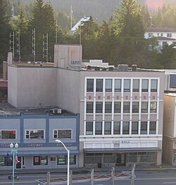 City (left) and former borough governments | 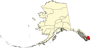 Location within the U.S. state of Alaska | 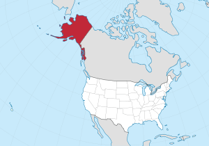 Alaska's location within the U.S. | | Country |  United States United States |
|---|
| State |  Alaska Alaska |
|---|
| Incorporated | September 6, 1963[1] |
|---|
| Seat | Ketchikan |
|---|
| Largest city | Ketchikan |
|---|
|
| • Total | 6,654 sq mi (17,230 km2) |
|---|
| • Land | 4,858 sq mi (12,580 km2) |
|---|
| • Water | 1,795 sq mi (4,650 km2) 27.0% |
|---|
|
| • Estimate (2018) | 13,918 |
|---|
| • Density | 2.8/sq mi (1.1/km2) |
|---|
| Time zone | UTC−9 (Alaska) |
|---|
| • Summer (DST) | UTC−8 (ADT) |
|---|
| Congressional district | At-large |
|---|
| Website | www.kgbak.us |
|---|
|
Ketchikan Gateway Borough |
|---|
|
City (left) and former borough governments | Location within the U.S. state of Alaska | Alaska's location within the U.S. | | Country | United States |
|---|
| State | Alaska |
|---|
| Incorporated | September 6, 1963[1] |
|---|
| Seat | Ketchikan |
|---|
| Largest city | Ketchikan |
|---|
|
| • Total | 6,654 sq mi (17,230 km2) |
|---|
| • Land | 4,858 sq mi (12,580 km2) |
|---|
| • Water | 1,795 sq mi (4,650 km2) 27.0% |
|---|
| Elevation | 123 ft (37 m) |
|---|
|
| • Estimate (2018) | 13,918 |
|---|
| • Density | 2.8/sq mi (1.1/km2) |
|---|
| Time zone | UTC−9 (Alaska) |
|---|
| • Summer (DST) | UTC−8 (ADT) |
|---|
| Congressional district | At-large |
|---|
| Website | www.kgbak.us |
|---|
|
Idaho County, Idaho[edit]
Template_talk:Infobox_U.S._county/Archive_3#Dual_time_zones
West Baton Rouge Parish, Louisiana[edit]
Parish, not county
Jackson County, Michigan[edit]
Livingston County, New York[edit]
Prince George's County, Maryland[edit]
Side by side comparison| {{Infobox U.S. county}} | {{Infobox U.S. county/sandbox}} |
|---|
Prince George's County |
|---|
|
| Prince George's County |  |
 Seal  Logo | | Nickname(s): "P.G. County", "P.G.", "Ward 9" | | Motto(s): "Semper Eadem"
(English: "Ever the Same") | 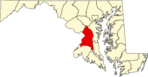 Location within the U.S. state of Maryland | 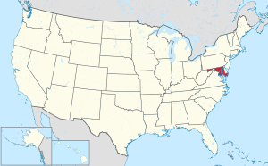 Maryland's location within the U.S. | | Coordinates: 1°2′3″N 4°5′6″W / 1.03417°N 4.08500°W / 1.03417; -4.08500 | | Country | United States |
|---|
| State |  Maryland Maryland |
|---|
| Founded | October 3, 1695 |
|---|
| Named for | Prince George of Denmark |
|---|
| Seat | Upper Marlboro |
|---|
| Largest city | Bowie |
|---|
|
| • Total | 499 sq mi (1,290 km2) |
|---|
| • Land | 483 sq mi (1,250 km2) |
|---|
| • Water | 16 sq mi (40 km2) 3.2% |
|---|
|
| • Estimate (2014) | 904,430 |
|---|
| • Density | 1,789/sq mi (691/km2) |
|---|
| Demonym(s) | Prince Georgian, P.G. Countyan |
|---|
| Time zone | UTC−5 (Eastern) |
|---|
| • Summer (DST) | UTC−4 (EDT) |
|---|
| ZIP Codes | 20607–20774 |
|---|
| Area code | 240, 301 |
|---|
| Congressional districts | 4th, 5th |
|---|
| Website | www.princegeorgescountymd.gov |
|---|
|
Prince George's County |
|---|
|
| Prince George's County | |
Seal Logo | | Nickname(s): "P.G. County", "P.G.", "Ward 9" | | Motto(s): "Semper Eadem"
(English: "Ever the Same") | Location within the U.S. state of Maryland | Maryland's location within the U.S. | | Coordinates: 1°2′3″N 4°5′6″W / 1.03417°N 4.08500°W / 1.03417; -4.08500 | | Country | United States |
|---|
| State | Maryland |
|---|
| Founded | October 3, 1695 |
|---|
| Named for | Prince George of Denmark |
|---|
| Seat | Upper Marlboro |
|---|
| Largest city | Bowie |
|---|
|
| • Total | 499 sq mi (1,290 km2) |
|---|
| • Land | 483 sq mi (1,250 km2) |
|---|
| • Water | 16 sq mi (40 km2) 3.2% |
|---|
|
| • Estimate (2014) | 904,430 |
|---|
| • Density | 1,789/sq mi (691/km2) |
|---|
| Demonym(s) | Prince Georgian, P.G. Countyan |
|---|
| Time zone | UTC−5 (Eastern) |
|---|
| • Summer (DST) | UTC−4 (EDT) |
|---|
| ZIP Codes | 20607–20774 |
|---|
| Area code | 240, 301 |
|---|
| Congressional districts | 4th, 5th |
|---|
| Website | www.princegeorgescountymd.gov |
|---|
|
Scioto County, Ohio[edit]
York County, Virginia[edit]


.svg)
.jpg)


