
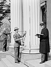
File:August, 1971. DT OF AQUEDUCT (ABOUT 800' E OF RT 15). - Hurricane Irrigation Canal, State Route 15 Vicinity, Hurricane, Washington County, UT HAER UTAH,27-HURI,1-13.tif

Size of this JPG preview of this TIF file: 800 × 568 pixels. Other resolutions: 320 × 227 pixels | 640 × 455 pixels | 1,024 × 727 pixels | 1,280 × 909 pixels | 2,560 × 1,819 pixels | 5,000 × 3,552 pixels.
Original file (5,000 × 3,552 pixels, file size: 16.94 MB, MIME type: image/tiff)
| This is a file from the Wikimedia Commons. Information from its description page there is shown below. Commons is a freely licensed media file repository. You can help. |
Summary
| August, 1971. DT OF AQUEDUCT (ABOUT 800' E OF RT 15). - Hurricane Irrigation Canal, State Route 15 Vicinity, Hurricane, Washington County, UT | ||||
|---|---|---|---|---|
| Photographer |
Boucher, Jack E. |
|||
| Title |
August, 1971. DT OF AQUEDUCT (ABOUT 800' E OF RT 15). - Hurricane Irrigation Canal, State Route 15 Vicinity, Hurricane, Washington County, UT |
|||
| Description |
Jepson, James; Steele, John |
|||
| Depicted place | Utah; Washington County; Hurricane | |||
| Date | Documentation compiled after 1968 | |||
| Dimensions | 5 x 7 in. | |||
| Current location |
Library of Congress Prints and Photographs Division Washington, D.C. 20540 USA http://hdl.loc.gov/loc.pnp/pp.print |
|||
| Accession number |
HAER UTAH,27-HURI,1-13 |
|||
| Credit line |
|
|||
| Notes |
|
|||
| Source | https://www.loc.gov/pictures/item/ut0130.photos.158938p | |||
| Permission (Reusing this file) |
|
|||
File history
Click on a date/time to view the file as it appeared at that time.
| Date/Time | Thumbnail | Dimensions | User | Comment | |
|---|---|---|---|---|---|
| current | 00:27, 4 August 2014 |  | 5,000 × 3,552 (16.94 MB) | Fæ | GWToolset: Creating mediafile for Fæ. HABS 2014-08-02 (3401:3600) |
File usage
The following pages on the English Wikipedia use this file (pages on other projects are not listed):